Parque Central Independencia (Independence Central Park)


Parque Central Independencia (Independence Central Park), Puerto Plata is an example of the colonial, ” modelo plaza central ” (central plaza model) found in most Spanish-colonial towns. The urban area would be built around the Plaza de Armas or Plaza Mayor (historically known as a central square) a concept originating from Spanish colonial urban planning. The Laws of the Indies mandated that a central space be made available for use as a functional hub for: civil, religious, public gathering, and military activities. The late 19th and 20th centuries saw the, “greening” of these spaces with gardens, fountains, and statues turning them into social leisure centers.
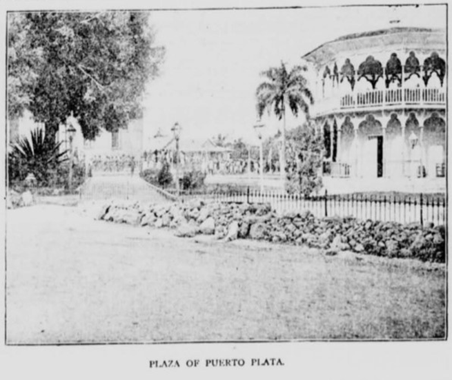
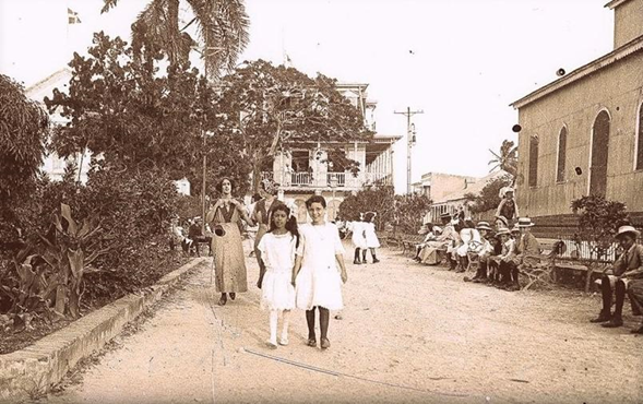
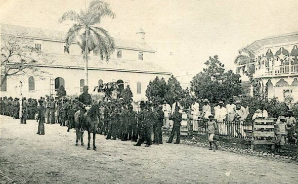
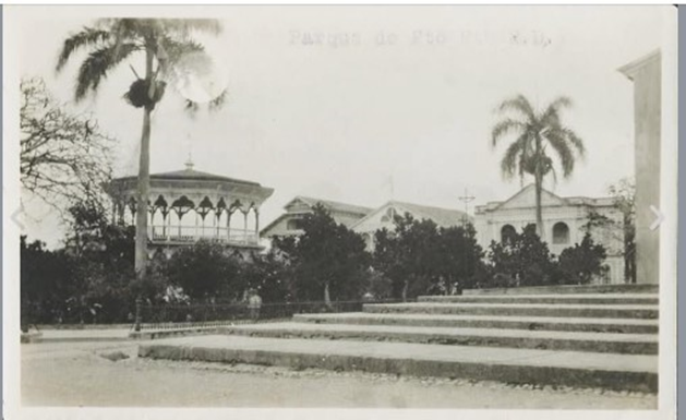
Puerto Plata’s central plaza was established in 1892 when the town served as the provisional capital of the Dominican Republic. Then President General Gregorio Luperón, a native born Puertoplateño gifted the park to the town. He knew that a structure was needed to beautify the space and serve as a symbol of the city’s progress and cultural identity. He proposed to city council that an original Victorian kiosk be brought from England and assembled in the square. The design was octagonal shaped with Moorish arches and distinctive cast-iron and wood trim characteristic of the era. Once approved, Luperón financed the transportation and assembly of the structure, Puerto Plata City Council provided the foundation.
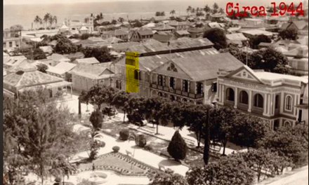
The 1930s saw the Dominican Republic become a dictatorship under Rafael Leónidas Trujillo. Under his rule, the regime made it a priority to replace local cultural symbols with cold structures that reflected a uniform vision of the country. Acting on orders from the regime Luperon’s English glorieta (gazebo) was destroyed and replaced with a reinforced concrete gazebo. The rigid, centralist, and modernist tastes of the Trujillo era replaced the historical landscape that had been developing in the country.
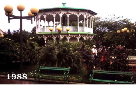
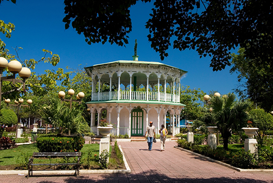
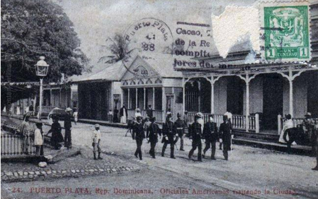
In 1982 a reconstruction of the original glorieta began. The original structure would be rebuilt respecting the absolute dimensions and intricate stylistic elements of the original design. With funding from the World Bank using old photographs (perhaps some of the ones shown here) and recovered plans engineers Carlos Camilo Hurtado and Humberto Mera led the project to restore the park’s historical essence and symbolic value. The aim was to take the park back to its original purpose as a social plaza where major artistic attractions could be presented.
In addition to physical changes Parque Central Independencia (Independence Central Park) experienced name changes over the years:
- Parque Independencia (Independence Park) (original name)
- Parque Julia Molina (Julia Molina Park)
- Parque Central (Central Park)
- Plaza de la Independencia (Independence Square)
- Parque Central Independencia (Independence Central Park) (current oficial name)
- Parque Central de Puerto Plata (Puerto Plata Central Park)
The most interesting name change occurred under the dictatorship of Rafael Trujillo. It was common practice for the regime to change official names of streets, monuments, and parks to honour family members. The idea, to pervade the everyday life of the people. Parque Independencia (Independence Park) became Parque Julia Molina (Julia Molina Park in recognition of his mother) by decree and remained so until 1961 when Trujillo was assassinated. The name of the park then reverted back to its original name, Parque Independencia (Independence Park). The current official name is currently Parque Central Independencia (Independence Central Park).
Twenty-eight years after the reconstruction of the glorieta, Dr. José Natalio Redondo Galán, then president of the Puerto Plata Tourism and Cultural Cluster announced a project to further improve the entire Historic Centre of Puerto Plata. The plan was to include:
- the entire area of Parque Central Independencia (Independence Central Park)
- Separation Street running north from Parque Central Independencia to the Malecón (pier)
- José del Carmen Ariza Street running north from Parque Central Independencia to the Malecón (pier)
- Mella Street up to the Pie del Fuerte (The Foot of the Fort) Neighbourhood exit
- Beller Street
- possibly Duarte Street
Upgrades were to include:
- reconstruction of 1.9 kilometers of streets
- installation of cobblestone in park plaza and sidewalks
- integration of sidewalks with the streets
- increasing width of sidewalks
- reducing street width to one lane
- provision of a small parking lane
- burying telephone lines
- burying electrical lines
The plan created a large plaza where festivals are held on a regular basis for all to enjoy.
1892 to 1938
c. 1901: add photo/ information re: fencing






1938 to 1983



1983 to 2010